Mapping System Services
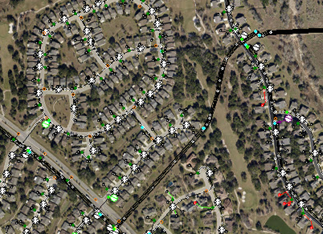
MEI provides mapping system services using global positioning system (GPS) field data collection to electric cooperatives and municipalities. Mapping services vary from providing direction and advice to providing a complete electric mapping system. For instance, we can assist clients in the beginning phase of setting up and integrating a new electronic mapping system, or clients with an established mapping system by performing a complete field data inventory of the electric system and producing an electric system model containing true electric connectivity that includes a “parent-child” relationship with all equipment (capacitors, fuses, regulators, switches, etc.), primary line, transformers, and consumers. The system model then allows for engineering analysis on the current mapping system. A full inventory can be performed on all facilities (poles, meters, transformers, capacitors, fuses, reclosers, regulators, switches, etc.) including all pole framing assembly units. All of the pole birthmarks, which include the height, class, and year of the pole, right-of-way clearing data, foreign (telephone, cable, and communications) contacts, and all street and security light poles can be collected. Collecting this data is an asset to multiple departments (e.g., mapping, engineering, operations, construction, planning, accounting, marketing, and management), and will aid in the upkeep and maintenance of the mapping system.
Services
- Global Positioning System (GPS) Field Data Collection
- Complete Facility Inventory
- Translation/Conversion of GPS Data to Mapping System
- Mapping System Setup/Integration,
- Custom Symbol Design,
- Accurate Data Mapping utilizing WindMil and WindMilMap by Milsoft Utility Solutions and ESRI and AutoCAD Map 3D (Autodesk, Inc.)
For more information about Mapping System Services, contact Paul Pustejovsky.
What Our Clients Have to Say…
McCord Engineering started providing work order inspections prior to 1989 and our relationship with McCord Engineering has grown to being our main engineering firm doing two year and long range work plans, sectionalizing studies, designing and inspection of transmission upgrades, and designing distribution work plan projects. We have found McCord Engineering to be very competent and innovative group using the latest technology such as lidar drones to survey and design distribution lines and assist us with any needs.
Clayton Stanford
Engineering Director
San Bernard Electric Co-op
McCord Engineering is one of the most innovative, forward looking, and technologically advanced consultants Mid-South Synergy have had the privilege to work with. We are proud to have them work with us on our Vegetation Management program using LIDAR and multispectral imagery, an approach that has changed the way we do vegetation management and has the potential to change the utility industry as a whole….
Dr. Comfort Manyame
GISP
MidSouth Synergy
McCord has provided Engineering services to the City of Georgetown since 1988. They are reliable, accurate, and responsive to all our needs and willing to go the extra mile in our behalf.
Jimmy L. Sikes
Electric Engineering Manager
Georgetown Utility Systems/Electric Division
McCord Engineering has been a tremendous resource for CoServ Electric since 1996. When we work with McCord, we are collaborating with engineering experts who are extremely knowledgeable, reliable and responsive to our needs and those of our Members. They consistently use cutting-edge technology and innovative practices to provide a quality product that is complete and efficient. Our track record with them is excellent, and they always commit the resources, time and talent to make our relationship a win-win.
Chris Skidmore
Manager of Major Designs and Standards | Engineering Services